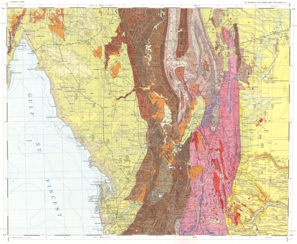
A Highlight Summary of the Barossa Landscape
- Many of the worlds wine regions have developed on sediments that have a recent origin and were created by the melting of ice sheets that began about 18,000 years ago. Most are dated at less than 12,000 years old. Some of the vineyards of Argentine, Chile, New Zealand, and Oregon-Washington are examples. Many other European, New Zealand, and South American vineyards grow on landscapes that are younger than 300,000 years with the main vineyards of Bordeaux being on terraces about 1,000,000 years old.
- The Barossa Valley is unusual because of the great age of the land surfaces, some of which can be traced back to 200 million years ago.
- The great age of the Barossa Valley has allowed numerous land surfaces to develop on a wide variety of underlying rocks and sediments dating from 200 million years to the present.
- The Valley part of the Barossa Valley began 35 million years ago and this Valley was filled over the next 30 million years with a tiny sequence of sediments carried in by streams from the surrounding low relief landscape.
- On average the Valley filled with less than 100 metres of sediment giving a rate of deposition of one millimetre per 30 years.
- The landscape of the Barossa Valley today with the major feature being the Eastern Range has been created in the last 5 million years.
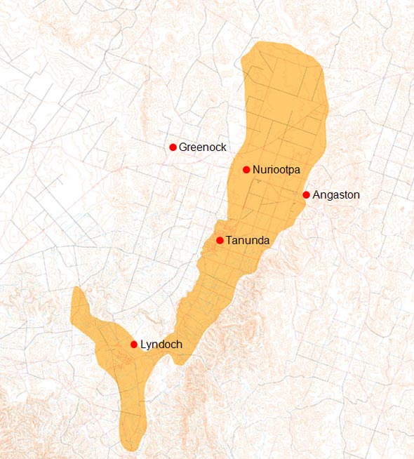
- The land surface of the Barossa Valley can be divided into 13 separate sub-regions with vineyards planted on 12 of these. These may or may not coincide with sub-regions that wine makers recognise as producing different tastes.
- The idea of sub-regionality while not new is gaining pace with many wineries referring to single vineyard sites and local district names.
General Information about the Barossa Valley
The Barossa Valley is a north east trending valley extending about 36 kilometres from Williamstown at the southern end of the Lyndoch Valley to St. Kitts Creek which closes off the northern end of the Barossa Valley. It is bounded by two ranges referred to here as the Western Ridge which is part of the North Mount Lofty Ranges and the Eastern Range which is part of the South Mount Lofty Ranges. The southern extension of the Eastern Range is also known as the Barossa Range.
The ‘flat lying’ part of the Barossa Valley varies from 2 (Lyndoch Valley) to 5 kilometres in width. Along both sides, the slopes into the Valley are covered with vines. Along the eastern edge this is mostly a simple slope off the Eastern Range but along the Western Ridge vines are planted many kilometres back into the slopes of the Range and often in well defined separate valleys such as Seppeltsfield. Including these vineyards the width of the Barossa Valley swells to 12 to 14 kilometres at its widest. The greatest density of vines is however along the spine of the Valley floor.
In 2007 there were 10,250 ha planted to grapes in the Barossa Valley, producing about 60,000 tonnes pa. Export statistics from the end of March 2008 (AWBC) for the Moving Annual Total (MAT) show that exports of Barossa branded bottled wines accounted for 28% of these grapes, exceeded 1.5 million cases and were valued at $146.6 million, giving an average price per 9 litre case of $97.73.
A Very Old Land Surface
Many if not most of the worlds vineyards are planted on land surfaces that are as young as 10,000 years old and go back about 1,000,000 years which covers for example the famous glacially derived river terraces of Bordeaux.
In the northern part of the Barossa Valley you can stand on a land surface that is 200 million years old. It must be one of the oldest in the world and is surely one of the oldest surfaces planted to vines. It’s a remnant of a great land surface that spread across the southern part of Australia and remained intact for 150 million years. Standing there I look across the rolling hills and realise that if I connect the remnant tops of this surface I can reconstruct how it looked. It was flat and rolled very gently not unlike the landscape further north of the Barossa and the conclusion you come to is that little has changed in all this time. By this I mean it has not moved up and has not moved down. To be preserved for such a vast amount of time requires a very, very stable setting-and such settings are very rare.
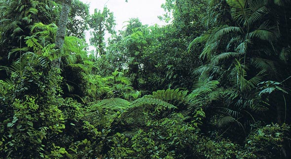
How this old, iron rich surface, tough and very resistant to erosion, slowly crumbled over the last 50 million years is the story of the Barossa. 50 million years ago the climate was sub-tropical, wet and humid and perhaps the Barossa looked like this.
The Barossa and Sub-Regionality
In this paper I would like to present some early ideas from landscape mapping of the Barossa Valley that I have been doing over the last 6 years. This is the first time I have discussed this research. The idea of sub-regionality in the Barossa goes back a long way but it has accelerated in the last two decades with many wineries having single vineyard wines with references on their labels to local names such as Stonewell, Ebenezer, Hill of Grace, the Lyndoch Valley and the like.
I believe that before wine people begin to think of lines and boundaries to define these sub-regions and draw these on a map they first need the right map. I have come to the conclusion that the best type of map is not a geological map, it is not a soil map, and it is not a topographic map but is a landscape map.
I will spend the first part of the paper developing a 35 million year history of the Barossa Valley. In the second part we will use what we have learnt to construct for the first time a landscape map of the Barossa valley. We will divide the landscape into units defined by a number of differences that makes each landscape different to its neighbour. These units may or may not have relevance or even coincide with sub-regions that winemakers feel express themselves in changing flavours. Some though do.
If none of what I set out has relevance to the general ideas of the site and its effect on wine, the debate about terroir, it will at least have achieved another of my aims which is to explain in non technical terms the very long history that has been needed to form the Barossa Valley. This type of information is useful to visitors to the Barossa and those who are required to talk about the Barossa.
A Brief History of How the Barossa Was Formed
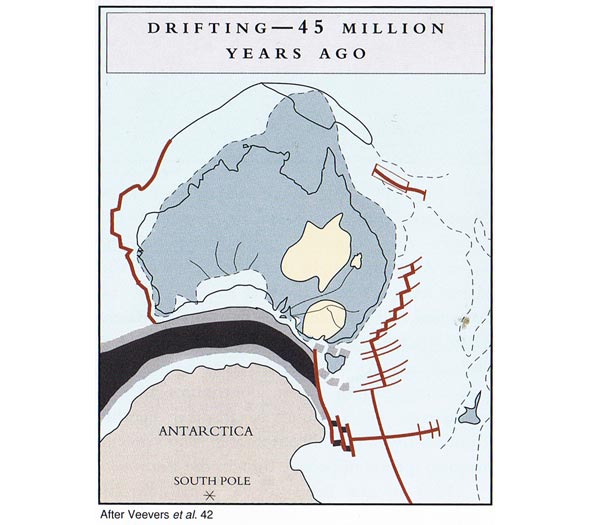
The great continents of Antarctica and Australia began to part 70 million years ago. About 50 million years ago this parting caused the area to the west of Adelaide to sink and a series of fault lines developed which sliced into the Mount Lofty Ranges and one of these now forms the eastern edge of McLaren Vale.
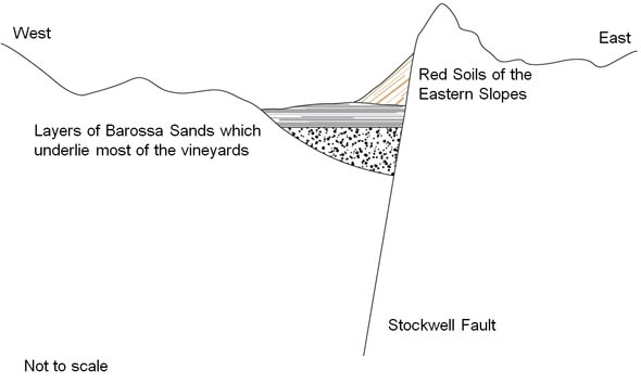
Sometime later, this date is uncertain but the best we have says around 35 million years ago, a fault developed on the eastern side of the Barossa and a small adjoining basin formed along the western side of this fault. This is called the Stockwell fault.
Explaining Faulting
What is a fault? How did this fracture occur and what would actually have happened?
To help understand this critical development I would like to quote two passages from the Voyage of the Beagle. They refer to a great earthquake that shook Chile on February 20th 1835.
“The mayor-domo at Quiriquina told me that the first notice he received of the earthquake was finding both the horse he rode, and himself, rolling together on the ground. Rising up he was again thrown down. He also told me that some cows which were standing on the steep sides of the island were rolled into the sea.”
“At the island of S. Maria the elevation was greater; on one part Captain Fitz Roy found beds of putrid mussel-shells still adhering to the rocks, ten feet above high water mark: the inhabitants had formerly dived at low water spring tides for these shells.”
Alas in the Barossa nothing as dramatic as these Chilean observations would have happened. An earthquake would have created a break in the land surface but whether it would have been visible as a scarp or a just a sag in the surface is hard to say. At best the fault line was a modest affair but it defined the eastern boundary of what was to become the Barossa Valley and the land surface to the west sank a little. Earthquake rumbles continued, enough indeed to crack the hard iron surface that had resisted erosion for 165 million years.
It would be nice to have a snap shot of the Barossa from the start and for each million years after, so we could have a running picture of what was happening. Alas, all we have is what we can discover in the way of preserved land surfaces and these will be rarer the further we go back in time. By their nature an old surface will only survive if it was created by a special event, one that gives the surface a chance to be preserved. Let’s see how many we can find?
The Barossa Valley – the Start
Running water is a very powerful erosional agent and while our iron rich surface can repair by re-cementing cracks and fissures the repeated faulting kept re-opening them allowing water to run down the fissures and slowly eat into the surface. As the valley grew in size erosion accelerated along the rising eastern surface and later spread to the western side.
Underlying the thick iron rich cap which has the technical term laterite and was perhaps 2 to 5 metres thick there are many metres of very soft and very fine grained pale cream to creamy grey clay. Once this is exposed it erodes very, very quickly. The original minerals that made up the fresh rock were totally reconstituted by the long weathering cycle-a significant feature that makes the Barossa different to most other vineyard regions. The primary minerals of the basement rocks corrode and may go into solution to form new minerals such as those rich in iron that formed the old cap or degrade into the soft clays referred to. The most resistant mineral quartz is much harder to dissolve (although it can happen) and survives lower down in the weathering profile and after the clays have been washed away it is the quartz that is left in the stream channels and spreads over the valley floor. During periods of gentle water flow the clays and fine grained muds settle out with the quartz.
There is no trace of the old cap at the base of the Barossa Valley, under the sediments, so it and the underlying clay layer were removed presumably by a stream running towards Lyndoch. Water boreholes tell us the first sediments were deposited on deeply weathered bed rock not on a fresh rock surface so some of the old weathered surface remained. This tends to suggest that the early streams were not vigorous enough to cut through the full sequence of weathered rock.
In this lower Barossa sequence there is also much evidence of carbonaceous matter and even weak seams of soft brown coal. This implies that after the first water washed sediments there were long periods of calm where the sediment that accumulated was mostly that of decaying plants and trees. Periodic jolting and uplift saw further layers of sands and muds deposited. These sediments the oldest in the Barossa Valley are not exposed and are only known from water bores. In the deepest parts of the valley about 60-80 metres of sediment accumulated. It is likely that streams flowed from both sides of the Barossa Valley to a central stream.
Perhaps this first phase of sedimentation in the valley lasted from 35 million years to 15 million years. When this phase of ‘valley building’ petered out the Barossa Valley, as defined by these valley sediments, not a wider definition based on vineyard distribution, was about 3.5 kilometres wide in the north and 2.5 kilometres wide in the south. This is a little more than half today’s valley width again based on the narrow definition of a valley filled with sediments.
Evidence of the North Para Emerges
Next it is believed that the water course of the valley moved from the eastern side to the western side of the valley as a ‘proto’ North Para River cut deeply into the basement rocks. This river was to the west of the Barossa Valley, as defined by the newly laid sediments, and why a new river course was cut is not known. There may have been a stream there already but we will never know. This renewal of vigorous stream activity may have marked a change to a much wetter, though still warm and humid climate. This stream was swift enough to erode away what remained of the older weathered surface and cut down into fresh bed rock. Steeply sided stream gullies can be seen at Rowland Flat and these were initially filled with quartz rich, rounded cobbles and pebbles that are well washed, meaning they contain little clay or mud. These early deposits pass upwards into finer but well sorted quartz rich sandy sediments. These same sediments were also deposited in streams and gullies on the eastern edge of the Barossa Valley and they presumably flowed into the proto North Para. As the original gullies filled it seems that the streams moved back and forth over a wider area, a braided pattern, though it is uncertain if the sands they left behind covered any of the first sediments that filled the Barossa Valley though it seems likely that they did at least at the southern end. A similar stream flowed down the western side of the Lyndoch Valley and the two streams merged at Lyndoch.
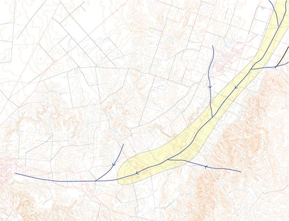
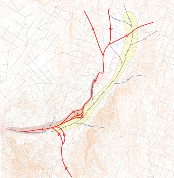
The proto North Para thus cut the original stream channel which is followed by the current North Para from south of Nuriootpa to Rowland Flat. At Rowland Flat the current North Para may have incised a new channel or else it has deepened a gully that was part of the proto North Para. At Rowland Flat the North Para has cut into the basement and is now 10 metres lower than the proto North Para – the evidence of which hangs high up in the North Para Gorge.
The sediments that we can see from this second period are not very thick and as they are coarse it seems sensible to see them as the result of a sudden climate change which produced fast flowing steams which could shift large cobbles. Streams brought sediment in from the gentle slopes of the western range but there is little evidence of upward movement of this range through the long history of the Barossa. It may also mark a period of renewed uplift along the eastern hills leading to further stripping of older surfaces and with steeper stream gradients a more vigorous erosional cycle commenced.
I speculate that this happened quickly and went from 15 to 13 million years. Perhaps 5-10 metres of sands were deposited.
Formation of Barossa Ironstone
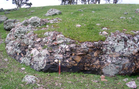
This activity was halted by the onset of a hot dry period with sparse rainfall and when it did rain little sediment was moved but iron from the crumbling old cap went into solution and trickled down the streams and flowed out onto the valley floor. The result of this hot spell and iron enriched water was to cement the surface of those quartz gravels recently deposited. This is an unusual and unique surface and the Barossa Ironstone forms a very tough cemented cap, as tough as concrete and from 10 centimetres to several metres in thickness. This surface is exposed among the western ridges, widens and underlies the Gomersal Plain and outcrops in numerous places south west to Lyndoch where it merges with the same surface that developed along the western and central part of the Lyndoch Valley. It may have a more widespread coverage than is currently known across the Barossa Valley although this is not indicated by water bores. Against that a single outcrop has been found on the eastern side of the Valley suggesting this surface was more widespread.
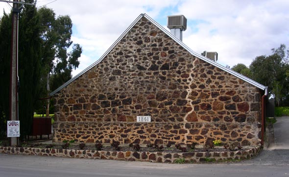
This was the stone used by early settlers as a building stone and numerous quarries and pits dot the western side of the Barossa. The tough nature of this ironstone has acted as a protective cap, just like the older 200 million year surface did, against erosion. Remarkably, outcrops can be followed along the western ranges for 15 kilometres and these preserve the stream gullies of that time and are fossilised stream courses. Two have been identified and its likely there is a third. In places the Barossa Ironstones are near the crest of hills or are the crest meaning that the surrounding hills have been removed and the valley floor with its stream is now the hill line.
How long should we say this climate change lasted? My guess is it took a long time to set in and finished abruptly. Sediments above this surface show minor signs that similar conditions were briefly repeated. I assign a 3 million year interval to the formation of this land surface with the condition that formed it finishing 10 million years ago.
The Climate Turns from Hot and Dry to Warm and Wet
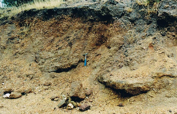
A return to a wetter period followed and sediments identical to those below the Barossa Ironstone were again deposited. Coarse, quartz rich gravels initially, but they graded quickly to finer quartz rich clays and muds and then rapidly upwards into fine, white to yellow, and yellow grey clays. The lower section is notable for being stained with rusted, clay particles and in quarries show a red and pink hue. These sediments were laid down by the same braided stream as previously and are consistent with those expected from the continuing erosion of the old iron rich surface. The fine white clays have their origin in the soft clay layers that have formed under the old iron rich cap. The coarser sediments filled the gullies cut by the proto North Para and then spread across the valley floor. It is these sediments that cover most of the surface of the floor of the Barossa Valley today and it is upon them that the vineyards along the central core of the Barossa are planted. At a maximum they are about 50 metres thick.
From water bores a map has been made of the Barossa Valley showing the thickness of sediments.
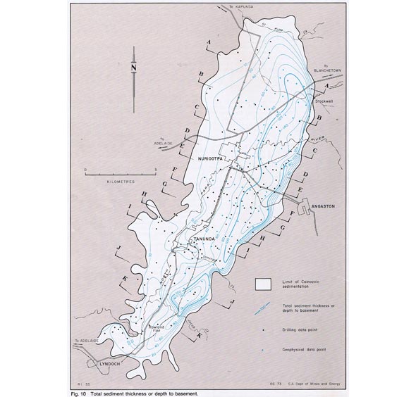
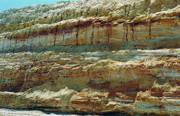
At about 5 million years a sedimentary cycle of 30 million years came to a close. For much of this time the Valley was in equilibrium with the bounding hills meaning that uplift of the eastern ranges and sinking of the valley occurred at about the same rate as evidenced by the gentle sedimentary cycle. So the ranges as they seen today did not exist back then and may have been only a few metres higher than the Barossa Valley. It is also worth recalling that the Mount Lofty-Fleurieu Peninsula was enclosed to the east, for long periods, by the Murray-Darling Sea which would have had a profound effect on the climate. The maximum thickness of sediment that filled the Barossa Valley is about 130-140 metres though on average it is less than 100 metres. This gives a rough rate of deposition of 1 millimetre every 20 years in the thickest sections or 1 millimetre every 30 years on average.
From 5 Million Years to the Present
After the last of the main sedimentary cycle that filled the Barossa Valley there was a period of quiet with no uplift or sedimentation. Climate conditions began to change rapidly as the current ice age developed, the significance of which is not only a cooling and drying continent meaning less water erosion, but also fierce winds. At some point the Mount Lofty Ranges again faulted and the eastern range began to rise rapidly. And for the first time they rose quicker than they could be eroded.
From this time to the present a great number of land surfaces have been identified. I have not been able to untangle the full sequence of events though work continues. Fortunately much of this is not relevant to a debate on sub-regionality of the Barossa – so much of it is skipped, though a general summary of what has been discovered is provided. In this period though some land surfaces have been created that have an immense bearing on sub-regionality and these are discussed.
Importance of the Eastern Slopes of the Barossa Valley
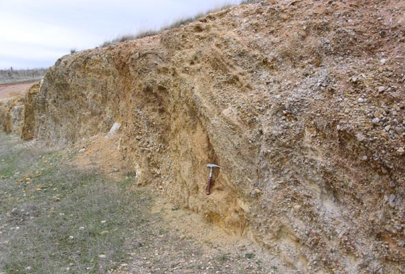
This renewal of faulting shook loose the bright red soils that had formed on the Eastern Range and these were washed into the Barossa Valley particularly in the NE corner of the Valley where they form a thick wedge of sediments, often pebbly, which can be greater than 20 metres thick and possibly as much as 40 metres. These sediments can be found along most of the eastern side though they are strongest north of Angaston and south of Rowland Flat. They have not washed out across the Valley floor as has at times been reported. Indeed it is surprising that almost no pebble or scree layers are found in any dams that have been dug into the flat parts of the Barossa Valley.
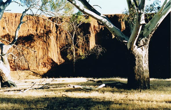
The renewed and vigorous uplift has been reported elsewhere in the Mount Lofty Ranges with suggestions of 600 metres of upward movement. We have an example in the Barossa of the Barossa Ironstone being elevated 270 metres from its likely position near the Valley floor. Here is the effect of this faulting on sands deposited in the period 15-13 million years ago.
A Summary of Recent Events in the Barossa Valley
There are numerous land surfaces that we do not have time to discuss in detail and these include;
recent windblown sands of which there are two and possibly three and vary in colour from grey-white to pale red brown; surfaces that have washed over other surfaces of which the Barossa has many; surfaces showing advanced calcium deposition; recent scree deposits that are younger than the large deposits that flowed off the eastern ranges, and many unusual soil types which remain unexplained. The dates of these are problematical although most have occurred in the last few 100,000 years and many have developed over the last 50,000 years. Some are discussed in the following section that divides the Barossa Valley and surrounds into landscape areas or sub-regions.
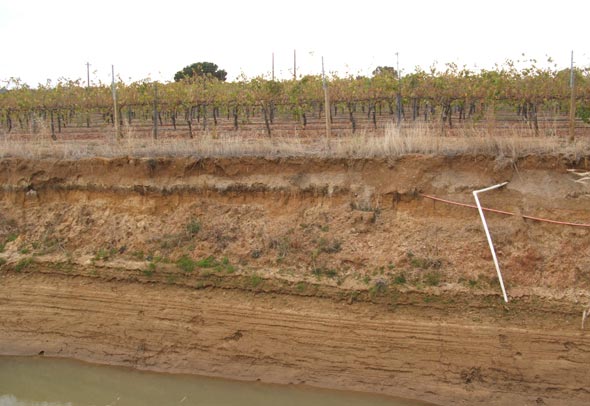
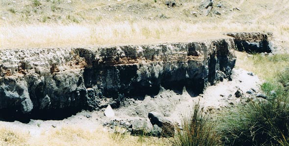
Figure 15 – 17 depict recent layering showing surfaces being overlain by younger surfaces.
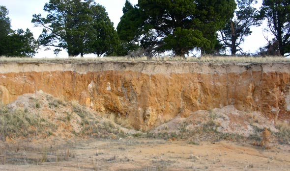
Other important landscape events include stream capture and diversion and there is some evidence that in this period the North Para flowed North West towards Kapunda and joined St. Kitts Creek while the Tanunda Creek has recently diverted and previously flowed down Rocky Valley.
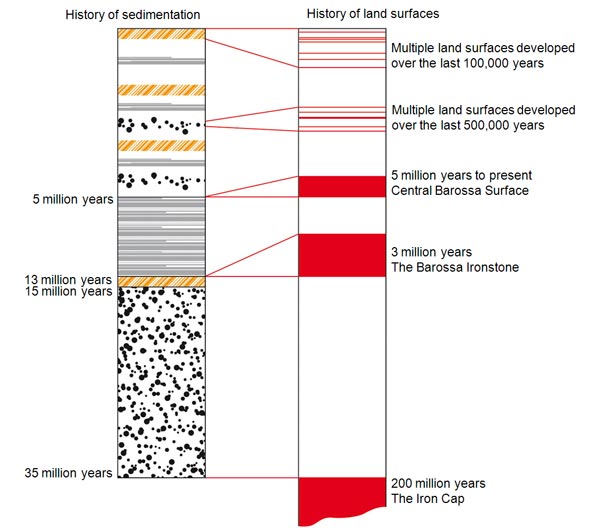
Figure 18 shows a Time Chart comparing the History of Sedimentation with the History of the Many Land surfaces. This diagram attempts to show by the thickness of the red lines that a land surface can have no thickness in the history of sedimentation but can have taken millions of years to be created.
Part II
The Landscape Surfaces of the Barossa Valley
The history we have built up over the 35 million year age of the Barossa Valley can be used to divide the land surface into discrete sub-regions. The current surface is to some extent a combination of all the previous surfaces that existed over this time and this is an important concept to understand when thinking about land surfaces. This is illustrated in our chart. While work continues on the land surfaces of the Barossa Valley currently 13 sub-regions are recognised.
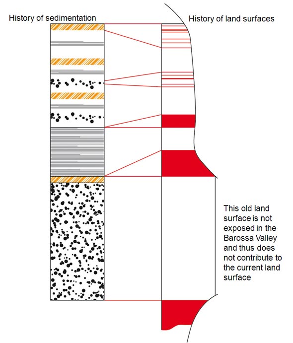
Figure 19 shows a Time Chart of the History of Sedimentation and History of the Land surfaces this time with the red lines cut into. This diagram attempts to show how the current land surface of the Barossa Valley is made from cutting into all the previous land surfaces (the red lines of various thicknesses) that have existed.
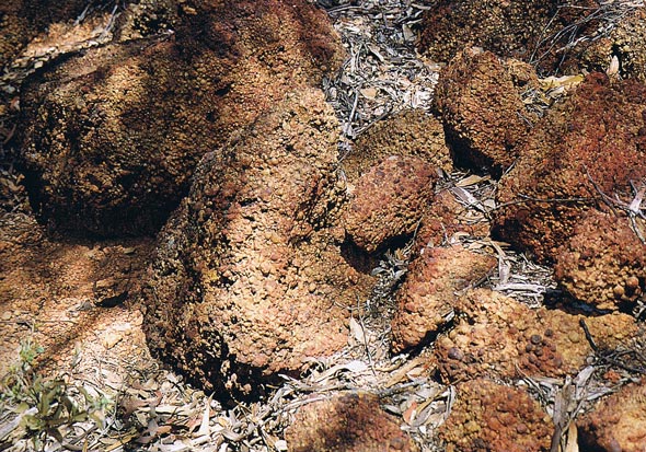
The Nodular Iron Surface – Koonunga Region of the North West-200 million years
The north-west corner of the Barossa Valley contains the last remnants of a great surface that covered much of Southern Australia. The iron rich cap rock (termed laterite) that has protected this Barossa surface is 200 million years old. Over the last 35 million years it has been slowly crumbling and is now absent in the rest of the Barossa Valley. The remnants that remain in this sub-region are underlain by a deep section of fine clays that are very soft and easily eroded. Lower down in this weathered profile the only original mineral that remains are quartz grains. Because of these surviving cap rocks and large areas of deeply weathered rock this area has enough unique characters to make it a sub-region.
The Greenock Hills Surface – 35 million years to recent
This surface reveals what happens when the protective cap rock of the Nodular Iron Surface is eroded. Areas of the weathered rock under the cap do exist but these are fast disappearing. This sub-region is controlled by the underlying grain of the basement rocks which trend north east-south west. As the old surface has been stripped the underlying relief of the basement geology now controls the development of the land surface. Softer rocks are eroded and tougher rocks become hill lines. The valley streams such as Greenock Creek and Marananga Creek are associated with very deep red brown alluvium which has been stripped from the hills. There are several distinctive valleys such as Seppeltsfield. Because of the exposure of the basement rocks, which can be still deeply weathered and the unusual nature of the ridge lines and valleys this is worthy of being a sub-region.

The Gomersal Plains – 35 million years to recent
A dramatic land surface that is controlled by a wide sheet of underlying Barossa Ironstone which being impermeable produces a perched water table. This leads to the cracking black soils of summer which are such a feature of this region and leads to waterlogged soils during the winter months. These soils are very black and are most un-Barossa which we associate with red soils. As you go south on this sub-region the Barossa Ironstone has been eroded and cracked and the soils take on a redder hue. Vineyards are planted on the southern end. While not important viticulturally this sub-region is one of the show pieces of the Barossa because of its unusual formation. Along the western rim recent windblown sands have deposited.
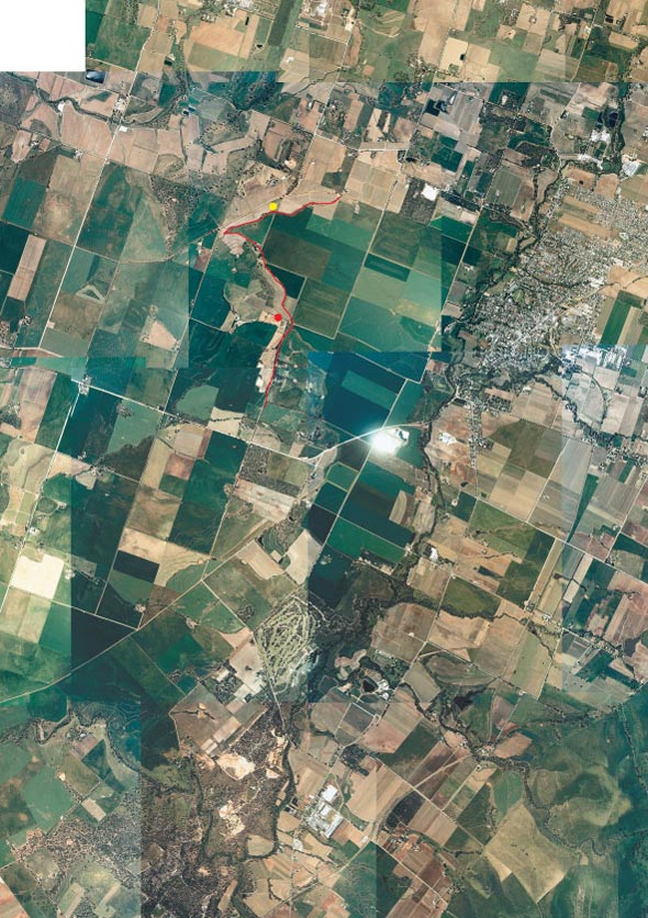
The Central Valley Surface – 5 million years to recent
North of Tanunda Creek or more correctly north of Chateau Tanunda and Basedow Road the Barossa Valley is remarkably flat. This is the central core of the Barossa Valley and extensive vineyards are planted on sediments aged from 10 to 5 million years though most of the plantings are on the most recent sediments at 5 million years. There are younger sediments that overlie these older sediments which are windblown and also water borne. These younger sediments are grey-white sands. This is a remarkably stable part of the Barossa Valley and even though the Eastern Ranges have risen rapidly quite recently little evidence can be found of sediment being washed off this range and flooding across the valley floor. An interesting and detailed soil survey of the Barossa Valley was done by Northcote in 1953-1954 and these observations and my own suggest that this surface could be further sub-divided. Regions such as Vine Vale for example have extensive areas of sandy soils which needs an explanation.
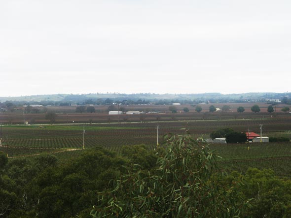
The Nodular Calcrete Surface – 3 million years to recent
Numerous dams dot the surface of the flat lying part of the Barossa Valley. These reveal a lot about the underlying sediments and a noticeable feature to look for is – do they show evidence that calcium has gone into solution or not? In most cases there is little evidence of calcium layers or nodules although they do occasionally occur. They are prominent though in a sub-region that extends from Nuriootpa to the North West where all exposures show prominent calcium deposition as calcrete. Growers and wine makers please note this is not ‘limestone’. Several exposures reveal thick calcrete deposition and even calcrete doming where the growth of the calcrete layer pushes up the surface soils. This sub-region is not surprising as it coincides with an old stream and a current damp course which is exactly where you find calcrete well developed. This is part of the evidence that suggest that the North Para River for a brief time in the last few hundred thousand years flowed north to Kapunda.
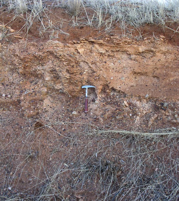
The Eastern Slopes Surface – last 300,000 years
The long period of the Barossa’s sedimentary history ceased about 5 million years ago. Sometime later the Eastern Range began to rise and at a faster pace than erosion could wear it down creating the landscape that we see today. It is possible to define within less than a hundred metres a lift from the floor of the Barossa Valley to the slopes that make up the sub-region called the Eastern Slopes. The underlying sediments of the slopes are bright red soils and rubble that has washed off the Eastern Range. On the and lower slopes these overlie the sediments and soils of the Central Valley Surface while higher up they overlie fresh and weathered basement. In the north eastern corner, the St. Kitts area, very thick red brown soils with layers of rounded but unsorted cobbles and pebbles form a thick sequence possibly 20 or more metres thick. After the St. Kitts area which extends down to Stockwell this sub-region is quite narrow and does not widen again until we reach the slopes north of Hoffnungsthal where red pebbly soils underlie the vineyards. This is a natural sub-region because of the slope. Observations from vineyard regions around the world suggest that slopes have an important bearing on grape flavours and because of this and the origin of the soils and underlying sediments (which are soils off the range) these slopes form a natural sub-region.
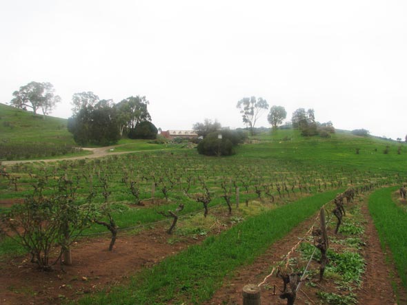
The Lyndoch Valley – 500,000 years to recent
This has proven to be a difficult valley to understand. An old surface of the Barossa Ironstone is well exposed along the western side and into the centre of the valley showing there was a water course before 13 million years ago and most of these water borne sediments have been turned into Barossa Ironstone although there are sands exposed below the Ironstone. We have no evidence from the valley that now exists as to when it was formed. Small hills of weathered basement rise through the valley floor, such as near St. Jacobi, which constrict the width of the valley and all the evidence suggests it is quite recent. If the valley is older we have no evidence, so it would seem plausible to say that the Lyndoch Valley is quite recent and the shape we see is a few hundreds of thousands of years in age. The Lyndoch Valley forms an enclosed natural sub-region and is restricted to the flat part of the overall valley. It is drained by the Lyndoch Creek which flows north into the North Para at Chateau Yaldara.
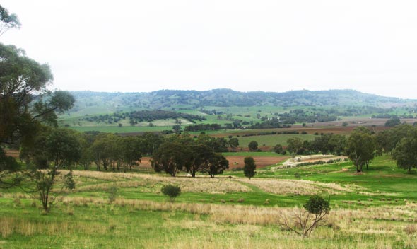
The Slopes of the Lyndoch Valley – 10 million years to recent
The slopes flowing down into the Lyndoch Valley make a sub-region with the western side being preserved by the Barossa Ironstone which was formed from 13 to 10 million years ago. The north east side is recent in age being part of the post 5 million year uplift, but they are placed in the same sub-region as it is believed slopes have an important bearing on grape flavours (refer to the Eastern Slopes sub-region).
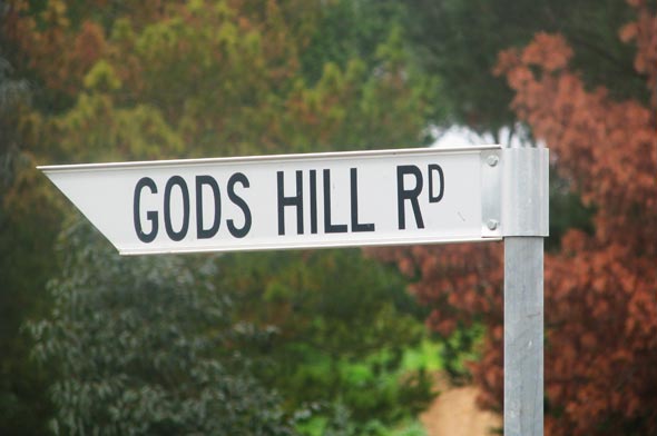
The Rolling Landscape of the Southern Barossa – last 300,000 years
The important landscape feature of the Barossa Valley south of Tanunda is the rolling nature of the surface versus the flatter nature of the surface north of Tanunda and that is why it deserves to be treated as a sub-region. The landscape is being eroded rapidly by the creeks, such as Jacobs Creek, that flow off the Eastern Ranges into the North Para River. The North Para is cutting a deep gorge into basement rocks and while the gorge is at its most impressive at Rowland Flat the erosion into the basement has now worked its way well north of Tanunda. As the gorge deepens the streams that flow into it in turn deepen and cut back further into the Valley sediments which lie mostly east of the North Para. In simple terms the southern end of the Valley is being quickly eroded with the sediments being flushed out via the North Para, into the Gawler River and on to the Gulf of St. Vincent. Sediments and rock rubble has tumbled off the rising Eastern Range and fringes this sub-region and is part of the Eastern Slopes sub-region, although it is surprising how little of this rubble there is.
The sediments exposed are those deposited above the Barossa Ironstone layer and are the same as those of the Central Valley Surface but depending upon what stage of erosion they are at are either of the same age or lower down in the sequence.
There is another important reason why this area is a sub-region and that is because the flatter surfaces, not yet affected by erosion, mostly north of Krondorf Road, the Kabininge area, have a deep profile of black to brown black soils (called locally Biscay soils). The reason for this soil colour is not understood and while it is not as black as the cracking black soils of the Gomersal Plain they may be related. This would mean that this area is underlain by Barossa Ironstone. While Barossa Ironstone is found just east of the North Para in the southern Barossa no other outcrops have been found to support this assumption and it is not noted in the logs of water bores. If proof is found for this area being underlain by Barossa Ironstone this in turn would require some revisions to the thinking in this paper. These soils extend beyond Tanunda Creek where they intermingle with redder soils till about Basedow Road though at this stage the sub-region is cut off at Tanunda Creek.
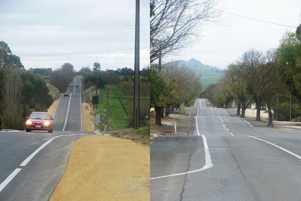
So this end of the valley would have looked like the Central Valley surface until erosion from the North Para and the tributaries that cross this surface started to actively erode and this creates the unusual rollercoaster feel as you drive from Tanunda to Rowland Flat.
The Red Pebble Soils of Rowland Flat
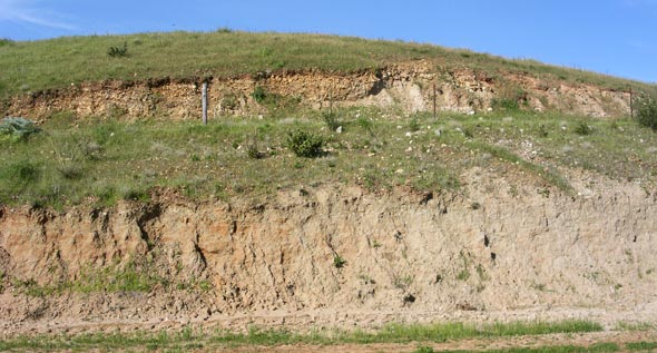
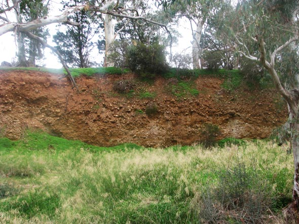
– 100,000 years Of all the sub-regions discussed the Red Pebble Soils of Rowland Flat may be the most interesting. This sub-region covers a small area and is noted for the bright red colour of the soils and mixed within a wide assortment of roughly rounded pebbles and cobbles many of which are granitic, the latter not being observed anywhere else in the Barossa Valley. This surface varies in thickness quickly and overlies older sediments of the Rolling Surface of the Southern Barossa and down into the creek bed of Jacobs Creek before it joins the North Para River. These sediments are landslide muds and pebbles that have been shaken loose from the high ranges around the Kaiser Stuhl probably by earthquakes at times when they were saturated with water.
The Red Pebble Soils are a very uneven surface lying on the top of hill crests and in the creek beds. The figure 29 shows them overlying older Barossa sands while figure 30 shows Jacobs Creek slicing through this surface and producing a wonderful exposure.
Hoffnungsthal Surface – 100,000 years to recent
Hoffnungsthal has great significance as a landscape feature because of its small drainage catchment with no drainage outlet. This is most unusual in a range being actively lifted and at the same time swiftly eroded. It is indeed hard to believe that since this basin formed it has never been filled enough times to overflow. Such a regular filling and overflow would overtime cause erosion of the rim at the overflow point and create a normal creek. This leads to the conclusion that it is a very young feature which in turn means recent uplift and movement at this end of the range. This in turn may be connected with the rise that separates the Lyndoch Valley from the Barossa Valley and may be responsible for altering the direction of drainage of the North Para at Rowland Flat. The North Para as explained originally flowed on to Lyndoch and Gawler and the right angle bend its now makes at Rowland Flat is one of the most spectacular land forms in the Barossa. It is likely that this dramatic change in direction is a recent event though against this the gorge has cut so far down into fresh bedrock that more time may be required to produce what we currently see. The age of the North Para Gorge is also linked of course to the age suggested for the Rolling Surface of the Southern Barossa as it has created that surface.

Grange Country – 50 million years to recent
The Grange surface sits between The Nodular Iron Surface and the Greenock Hills Surface and is a hybrid of both containing deeply weathered rocks characteristic of the northern surface and a land surface controlled by the ‘grain’ of the recently exposed basement rocks typical of the Greenock Hills Surface. It would not warrant a separate sub-region apart from one remarkable feature that is possesses that is uncommon elsewhere in the Barossa Valley. It is the only area in the Barossa Valley that has extensive sand cover and that varies from a thin veneer to one metre deep drifts and includes from six to eight east-west trending sand dunes that rise from one metre to four metres above the surface. These windblown sands maybe of recent origin being post the last ice age which finished 18,000 years ago although they may have been created by the fierce winds that would have blown during the colder period when more of the coastline was exposed. They overlie of course the same soils as are found in the sub-regions to the north and south. The originator of Grange, Max Schubert spoke in glowing terms of the wines that come from the Kalimna Sands and this is supported by current winemakers. Many vineyards in this region make wine that is included in Grange or can be of Grange quality.
Why sand is so common in this area is still being investigated as is its origin which is a long way away and as suggested may be from the exposed sea floor of St. Vincent’s Gulf and Spencer’s Gulf which would date back to 18,000 years.
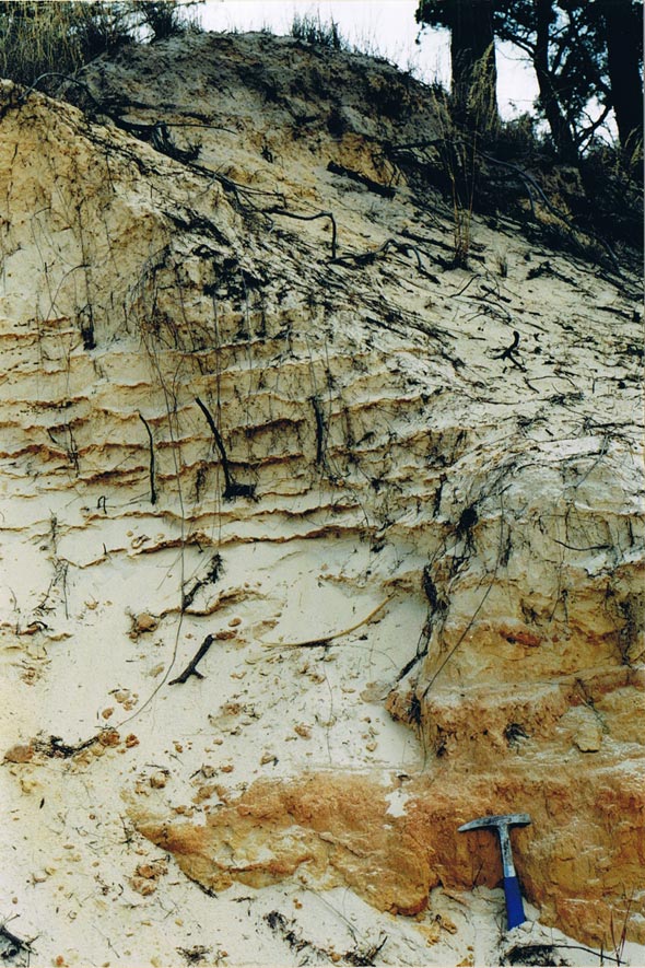
About 15 individual layers in the Kalimna sands can be counted and these are remarkable as the crusty layers, one to two millimetres thick are red brown in colour and show slight pitting on the surface. It is thought that they represent stormy events with clouds of red dust from inland Australia coating the sand dunes as light rain began to fall.
The Vineyards of the North Para Flats-last 200,000 years until recent
This sub-region is not marked on our map but it is worth mentioning that a few vineyards are on river flats that adjoin the North Para River. These are found next to the North Para south of the Peter Lehmann-Richmond Grove wineries and are mostly in the far southern Barossa near Rowland Flat. They are planted in rich river alluvium probably of recent age. River flats that are planted with vines also adjoin Tanunda Creek. Some of these river flats have cut back many hundreds of metres into the older Barossa sediments a process that may have taken hundreds of thousands of years.
The Thirteen Land Surfaces of the Barossa Valley
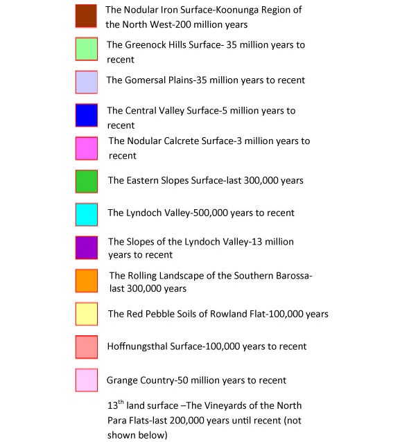
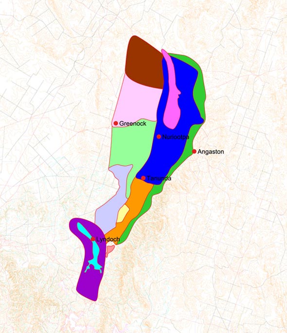
At this stage it is proposed that 13 sub-regions of the Barossa Valley can be recognised. It is very hard to date these surfaces and the ages given are at best an educated guess although bounded by what we know about the age of similar features elsewhere in the Mount Lofty Ranges. The thirteen land surfaces or sub-regions are as follows:
Summary
Hopefully this map will serve several purposes. It will assist in the ongoing debate about sub-regionality of the Barossa Valley as defined by differing wine types. It also provides another way of thinking about the Barossa Valley which will be of use to those who need to talk about the Barossa Valley and about its wines and why they are different. This paper sets out for the first time what has been learnt about the Barossa Valley since mapping the landscape began in 2001. This work continues and many problems remain that are not mentioned here. With that said the general summary given is unlikely to alter in a major way.
References and further reading
Cobb, M.A., (1986): Groundwater Resources of the Barossa Valley, Report of Investigations 55. Department of Mines and Energy, Geological Survey of S.A.
Drexel, J.F. and Preiss, W.V. (Eds), (1995): The geology of South Australia. Vol. 2, The Phanerozoic. South Australia Geological Survey.
Northcote, K.H., J.S. Russell, C.B. Wells (1949-1955): Various Soil Maps of the Barossa and Surrounds, CSIRO Division of Soils.
Thomson, B.P. (1969): Adelaide Geological Map, Geological Survey of South Australia.
Veevers, J.J., Powell, C.McA. & Roots, S.R. (1991): Review of seafloor spreading around Australia. 1. Synthesis of the patterns of spreading. Aust. J. Earth Sci. 38, 373-389.
White, Mary. E. (1994): After the Greening-The Browning of Australia. Kangaroo Press.
South Australian Winegrape Utilisation and Pricing Survey, (2007). Phylloxera and Grape Industry Board of South Australia.
South Australian Winegrape Utilisation and Pricing Survey, (2007): Phylloxera and Grape Industry Board of South Australia, Stepney SA.
